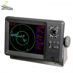
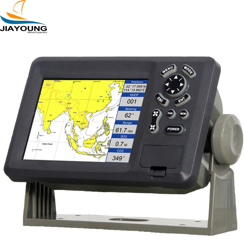
5.7” Color LCD GPS Plotter/compatible with C-Map MAX

Short Description:
1.High resolution TFT day-view LCD display 2.SD-cards slot for C-Map MAX and user data 3.C-Map MAX and K-Chart Selectable 4.Tide table 5.Versatile display mode include 6.GOTO track navigation 7.Map orientation select 8. Proximity waypoints alarms 9. Perspective View 10. Palette PLOTTER CHARACTERISTICS Waypoints/icons 15,000 waypoints with name, symbol, 10 proximity waypoint Routes waypoint up to 200 points each, plus MOB and Track Navigation or Go to Track modes Tracks 30,000 poin...
Product Detail
Product Tags
1.High resolution TFT day-view LCD display
2.SD-cards slot for C-Map MAX and user data
3.C-Map MAX and K-Chart Selectable
4.Tide table
5.Versatile display mode include
6.GOTO track navigation
7.Map orientation select
8. Proximity waypoints alarms
9. Perspective View
10. Palette
| PLOTTER CHARACTERISTICS | |
| Waypoints/icons | 15,000 waypoints with name, symbol, 10 proximity waypoint |
| Routes | waypoint up to 200 points each, plus MOB and Track Navigation or Go to Track modes |
| Tracks | 30,000 point automatic track log; 15 saved track (up to 2000 track points each) let you retrace your path in both directions |
| Alarms | XTE, Anchor drag, arrival, speed, voltage, proximity waypoint and time, AIS alarm. |
| Pallete | NormalDaylight exposed to sunlightNight in dark environmentNOAA paper chart colors |
| Tides | Tide data |
| Projection | Mercator projection |
| Position format | Lat/Lon |
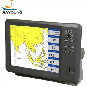
| Basemap | Built-in K-Chart |
| External Map | SD Cards slot for C-Map MAX |
| User data storage | Internal backup of user settings, or external SD-card |
| Plot Interval | 1s to 99h or 0.01 nm to 9.99nm |
| Plotting scales | 0.01nm to 1,000nm |
| Nav Data | Inputs: $–DBT, $–DPT, $–GGA, $–GLL,$–GSA, $–GSV, $–HDG,$–HDM,$–HDT,$–MTW, $–RMB,$–RMC, $–VTG, $–ZDA, $–VWR,$–VWT,$–MWD, $–VPW Outputs: $–AAM, $–APB, $–BOD,$–BWC,$–GGA, $–GLL, $–RMB,$–RMC,$–VTG, $–XTE, $–ZDA Outputs for autopilot: $–AAM, $–APB, $–BOD,$–VTG |
| Perspective View | On/off |
| POWER SUPPLY | 10.5 to 35VDC, current drain <300mA at 12V |
| PHYSICAL | |
| Size | 228mm(H)X138mm(W)X79mm(D) |
| Weight | 0.9kg |
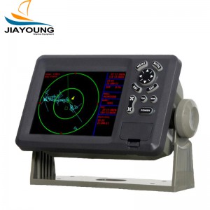
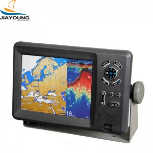
| Display | 5.6-inches ColorTFT day-view LCD 640 X 480 pixels |
| Waterproofing | Display unit: IPX5 Antenna unit: IPX6 |
| Temperature range | Display unit: -15℃ to +55℃ Antenna unit: -25℃ to +70℃ |
| GPS RECEIVER CHARACTERISTICS | |
| Receiver | 12 parallel channel GPS receiver continuously Tracks and uses up to 12 satellites to compute and update your position |
| Acquisition times | Cold start: 60 seconds average Warm start: 45 seconds average Hot start: 15 seconds average |
| Update rate | 1/second,continuous |
| Accuracy | Position: <15 meters(95%) without S/A Velocity: 0.1 Meter/sec without S/A Time: ±100ns synchronized to GPS time |
| Dynamics | Altitude: 18,000m Max Velocity: 500 m/s Acceleration: 4g Max |
| Datum | WGS 84 & Others |
| Interfaces | NMEA 0183 input and output,RS232 and RS422 output |
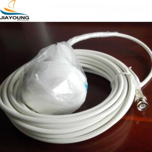
| Antenna | KA07 |
| AIS INTERFACE | |
| Data input | NMEA 0183 , R8232 |
| Baud rate | 38400 and 4800 |
| EQUIPMENT LIST | |
| Display unitAntenna unit with 10m cableOperation manualInstallation materials and standard spare parts | |